Clearwater River Float and Trail
Added 2021-07-14
Quick Summary
- 3.5 miles paddling on a meandering river through willow groves
- Can get away without a 2nd vehicle spotting boats
- Fun to navigate, lots of oxbows in the river, getting lost is half the fun!
- Turtles, fish, and birds along the way
Photos

Story
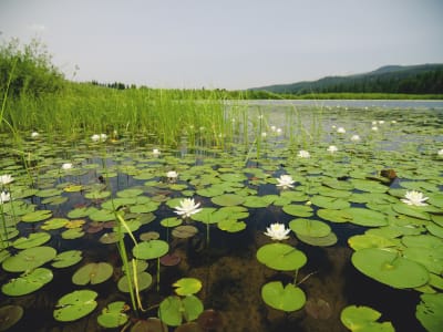
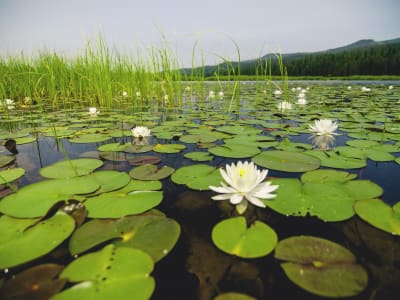
The river winds and bends so much on this paddle that you can avoid using a second vehicle to spot boats. Go to the top of the float and drop your boats, then drive to the end and park your car near the ranger station. From there it only takes about 15-20 minutes to hike back up to the boats (it's about 1 mile hiking between the ranger station and top of the float). The river is like a delightful maze of bends, willow groves, and tiny ponds. Once you get into Seeley Lake there are often lily pads growing, and the mountains are pretty.
Directions to the trailhead: from the town of Seeley Lake, travel 3.7 miles north on Montana highway 83. Take Forest Service Road #17597 (west side of the highway) and travel 0.7 miles to the trailhead.
Directions to the ranger station/take-out point: The canoe trail take-out point, loading area, and parking area/restroom, is behind the Seeley Lake Ranger Station. Leaving the trailhead, travel back to the intersection where Forest Service Road #17597 meets Montana highway 83. Head south 0.7 miles to the ranger station (follow signs) back toward the town of Seeley Lake. The parking lot, loading area, and take-out point are behind the ranger station, between the lake and the ranger station.